A Flood and a Forest: When Brahma’s Son Engulfs Kaziranga
- As Kaziranga National Park goes through another cycle of its annual floods, here’s a look at what it means for those on the frontlines.
Writer and photographer for Roundglass Sustain.
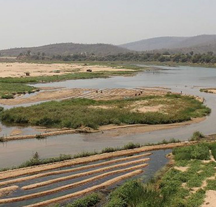
“Look at the Meteka, water hyacinth (Eichhornia crassipes) flowing in the reverse direction towards the Karbi hills. It shows that the Brahmaputra has started swelling up and now its water, which earlier emptied into the river, is flowing up these channels. The floodwater will soon engulf this vast expanse of the grassland in a couple of days,” exclaimed Bir Bahadur Chetry, a forest guard who has worked for over three decades in Assam’s Kaziranga National Park. Standing on one of the wooden bridges on Mori Diffulu River with him, I could see five rhinos grazing at a distance, not far from a herd of eastern swamp deer. It was July 11, 2019. On July 14, more than 70 percent of the park was inundated by floodwater. Experienced frontline staff of Kaziranga are excellent readers of nature.
My close association with habitats along the Ganges, Teesta, Son, Narmada and Brahmaputra remind me how rivers have shaped human civilisations. However, in the recent past, technological advancements have made humanity embark on an expedition to alter these geological wonders. The Nile in Egypt, the Mekong in Cambodia, the Rhine in Europe have witnessed humankind’s unkind domination. The Brahmaputra hasn’t been tamed to a great extent yet, and continues to shape the future of millions of human beings and non-human life forms all along its course. Every monsoon, the river floods two-third of Kaziranga National Park, submerging it and blessing it with new life. When Brahma’s untamed son spreads its arms, Kaziranga comes alive with joy — like a child in its mother’s arms.

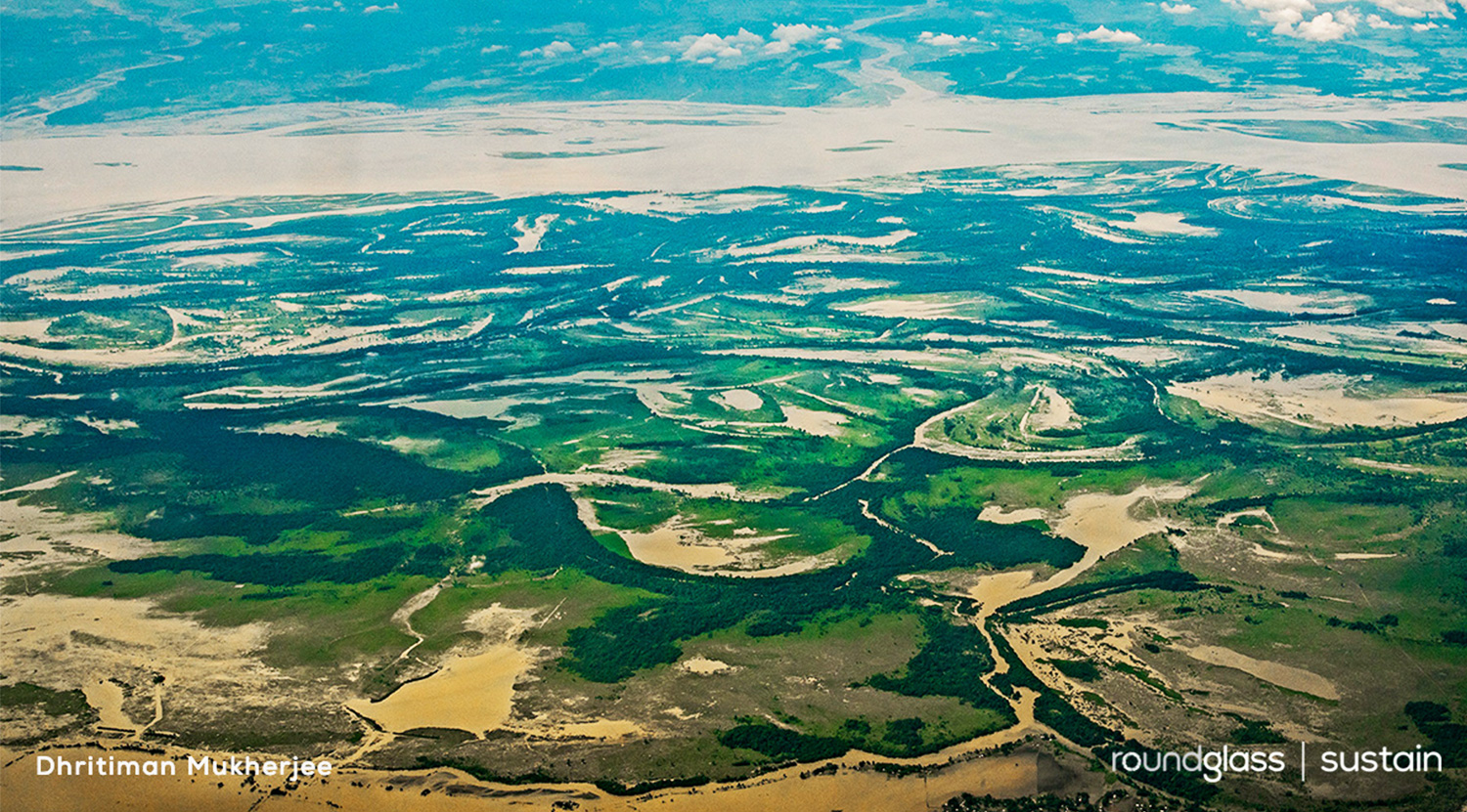
Cover photo: Every monsoon, the Brahmaputra swells and swallows two-third of Kaziranga National Park, a Unesco World Heritage Site. The floods are necessary for the rejuvenation and survival of the park. Cover photo: Dhritiman Mukherjee
Kaziranga and the Brahmaputra
Kaziranga National Park — a floodplain carved, curated and composed by the Brahmaputra — is a complex ecosystem. As much as it owes the river its geological morphology, it largely depends on it for survival. The annual floods replenish the wetlands with water and nutrients, cleanse the landscape of weeds, and redistribute fish. When the forest floods, the animals take refuge along the elevated Karbi hills on the southern end of the park. In the 21st century, when the forces of nature seem to undergo human domination, Kaziranga still follows the process of natural selection. The sick, debilitated and unfit perish in the flood to make room for the fittest.
Development, as we perceive it, has always defied the forces of nature. Kaziranga is no exception. NH37, a national highway, and lifeline for Northeast India slices through this critical connection between Kaziranga and Karbi hills. Over the years, the highway is increasingly getting impregnable for the wild. The nine known wildlife corridors on the highway — Panbari, Haldibari, Bagori, Harmati, Kanchanjuri, Hatidandi, Deosur, Chirang and Amguri — are choked by traffic. Mushrooming of hotels, restaurants, shops, and ancillary structures of the tea industry have gravely compromised the integrity of the corridors on the highway.
Getting ready for the floods
The managers of Kaziranga National Park prepare for months before the annual flood. While the time of flooding is unpredictable, a close eye on the updates of the Central Water Commission, a government body, helps understand the trend of the river flow. A meeting called by the park’s director, around three months before the flood, sets the tone for flood preparedness. It helps develop a module of networking between the civil administration, park authority, non-governmental organisations, local communities and various media outfits. The aim is to reduce the vulnerability of wild animals, inhabitants of the fringe villages and the rural livestock.

An active interface exists where wild animals and livestock share space. With better knowledge and understanding of the risk patterns and disease outbreaks, a massive door-to-door vaccination is organised every year. While the livestock immunisation protects farmers from incurring losses, the park gets ready to defend its wild herbivores from a possible disease outbreak when the flood blurs the boundaries and all forms of life share one giant space.
Once the livestock and wild animals are secured from pathogens, village-to-village meetings are organised. The range officers share their concern for the physical safety of the wild animals during these village-level meetings and explain legal protection of the wild animals under the Wildlife (Protection) Act, 1972. This is done to create awareness against poaching and harming wild animals that are rendered vulnerable during the floods. The Village Defence Party, mostly made up of local youth from communities around the forest, get torchlights and raincoats. They actively patrol the area to identify human-wildlife conflict, guard crops from wild herbivores, and stay in touch with the forest department.
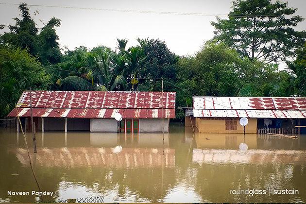
The villagers along the Brahmaputra have evolved with the course of the river. I have not seen a confrontation with surging waters in the villages, rather a respectful submission at the first dawn after the river engulfs their homes. The Brahmaputra is revered. Assamese folk songs appreciating the blessings of the river stand as a testimony of love and respect. When the flood hits, people take shelter on elevated lands, bunds and roads. Their livestock follow cautiously. Sometimes stressed domestic animals and wild animals accidently confront each other and injuries aren’t uncommon. Three highlands have been built by The Corbett Foundation outside the protected areas in the villages near the eastern range that come in handy for over seven hundred livestock and their keepers.
Section 144 is imposed along the NH37 to restrict the speed of vehicles. Barricades are placed along the highway between Panbari and Aamguri where wild animals are known to cross and move towards the Karbi hills. An additional team of vets from Wildlife Trust of India-led rescue centre are also placed at the Western range, Bagori for clinical treatment of injured wild animals. The Corbett Foundation lends support to the ongoing emergency relief work for stranded and injured wild animals.
Artificial highlands: Are they a solution?
As I write this piece, on April 24, 2020, I see a Facebook post by Prakash Javadekar, the Minister of Environment, Forest and Climate Change stressing that he has directed that more highlands may be made for wild animals to take shelter at the time of the floods.
Around three dozen elevated structures have already been made inside the park for the wild animals to rest during the flood. These highlands provide a “breather” for them when they have to swim long stretches of endless water. However, many images of rhinos on the highlands have made several rounds on Facebook and Twitter, painting these highlands as “saviours”. Such perceptions could be misleading.
Speaking on the issue, P Sivakumar, field director of Kaziranga Tiger Reserve said, “No more new highlands inside core areas will be encouraged. The existing central road will be strengthened. Priority will be given for buffer and corridor areas like Banderdubi, Deosur, Panpur and Laokhowa.”
Emphasis should be on establishing viable corridors for animals to travel from Kaziranga to the Karbi hills. Asian elephant, one-horned rhinoceros, eastern swamp deer, Bengal tiger, hog deer, sambar, wild buffalo, wild boar and snakes like king cobra, monocled cobra, Burmese python and many others endeavour to cross the highway in search of natural highlands. Artificial highlands are no match for the scale of the crisis. “Securing the connectivity with the Karbi hills is much more important than creating these high banks. One should also look at the ecological cost/disturbances of creating these high banks,” said Dr AJT Johnsingh, senior ecologist and author.
When from a distance I saw one of the highlands in Kaziranga on July 16, 2019, a conglomeration of rhinos, swamp deer, hog deer, wild buffalo and wild boar were standing in close proximity. Given my background in veterinary science, I was almost immediately concerned about the possibility of the transmission and spread of diseases if such highlands are preferred over corridor connectivity. I hope competent people guide policymakers to strengthen the functionality of existing corridors, rather than making more highlands.

As the floodwater recedes, farmers get back to their villages, women repair the mud walls of their huts, wild animals return, and the park authority assesses the loss of lives inside the park. The mighty Brahmaputra folds itself back to being a lazy, meandering river. And a new cycle of life and renewal unfolds in Kaziranga.
As I stand in silence, witnessing the larger canvas of Assam with gratitude, I add another layer to memories of this beloved landscape. Long live Kaziranga!
First published in RoundGlass Sustain, a treasure trove of stories on India’s wildlife, habitats and their conservation.

