Deadly landslides are becoming Kerala’s new reality every monsoon
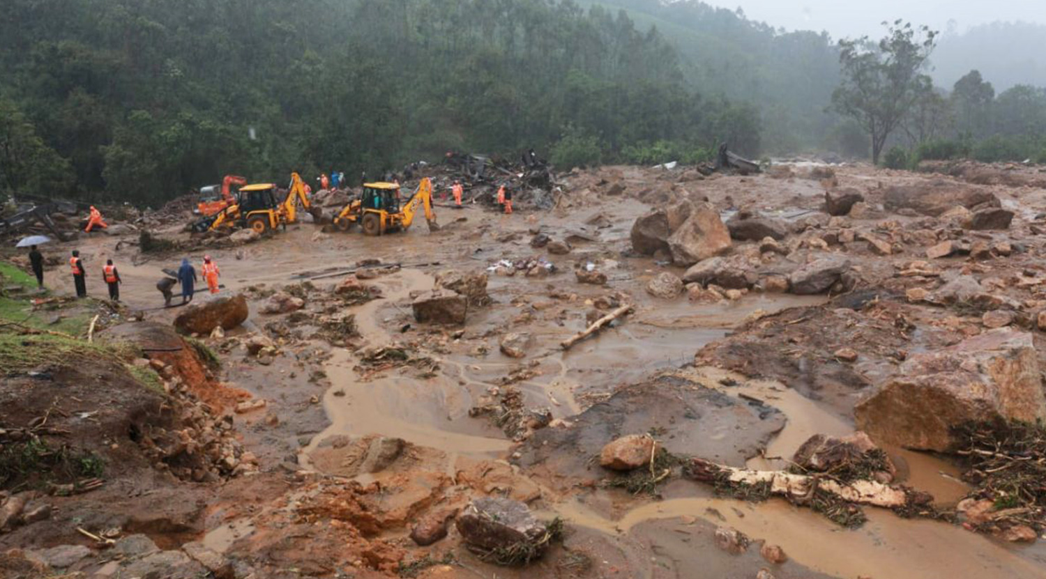
- The August 7 landslide at Pettimudi in Kerala’s Idukki district in which 49 plantation workers were buried alive necessitates a micro-level landslide hazard mapping for the state apart from relocation and rehabilitation of people from ecologically fragile danger zones.
- As many as 145 people died in landslides in the last two years in Kerala. The latest tragedy indicates that massive rains and major landslides would continue to be annual affairs. A policy for people living in ecologically fragile areas prone to yearly landslides and floods is needed.
- Quarrying, razing hills for constructions, massive scale road constructions, and expansions in the mountains and mono-crop cultivations are turning contributing factors in the landslides happening because of incessant rains of high magnitude induced by climate change.
P. Mayilswami and his brother Ganeshan, members of an Eco-Development Committee (EDC) in Kerala, had reasons to feel elated in June this year. The brothers were engaged in the conservation of the endangered Nilgiri tahrs in Eravikulam National Park for three decades. The calving season had just concluded, and the hoofed mammals birthed 155 individuals.
The brothers had studied only up to primary class. Still, they were known for their valuable contributions in the habitat protection and tourism management of the park, according to local forest range officer Job J. Neriyamparambil. The national park is near Munnar, a famous hill station in Kerala’s Idukki district.
As this year’s calving season ended during the COVID-19 lockdown, visitors were absent, and as a result, there were no celebrations. But the brothers insisted with the range officer for a gala event in the post-pandemic phase to celebrate the achievement.
In the previous calving season (in 2019), the number of new births was 81. As many as 75 calves were born in 2018, and 87 in 2017. Now the total number of tahrs in Eravikulam has risen to 726, an all-time high.
Mayilswami and Ganeshan were “faces of conservation” in Eravikulam, and they had played a significant role in the sustainable management of the national park, said Neriyamparambil.
But in the early hours of August 7, 2020, a deadly landslide at Pettimudy, a plantation village in the foothills of Rajamala stretch of Eravikulam, buried the brothers and their families under mud and rubble of their line houses, locally called ‘layams.’
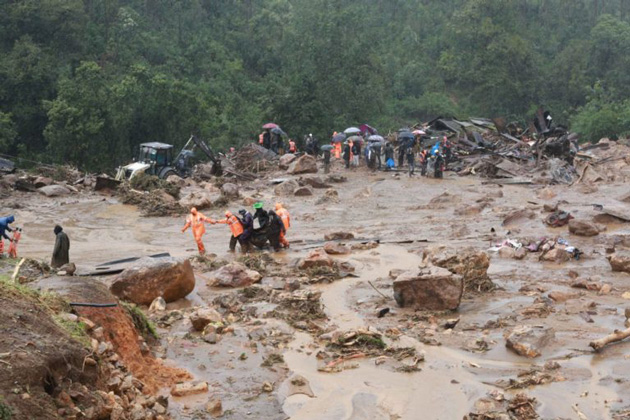
Rescue workers are yet to trace them. A portion of Rajamalai came crashing down on a cluster of line houses of estate workers at Pettimudi. The death toll from the incident is 49 and 22 are still missing. Former estate workers, Ganeshan and Mayilswamy were also residents of the colony comprising 40 line houses, which swept away in the landslide accompanied by torrential rains.
Only 12 people belonging to two families had escaped the tragedy. Till Sunday evening, 42 bodies were recovered. There is no trace of others who were present in the colony when disaster struck.
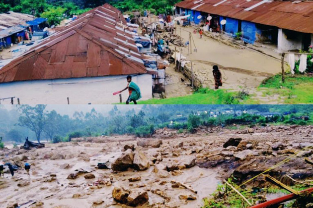
According to local gram panchayat member M Shantha, heavy rains had almost isolated the cluster of houses for the last one week, and there was no power supply in the colony for four days. “As a result, mobile phones were not functioning. People living in the upper colony woke up hearing the sound. But nothing could be done as it was pitch dark,” she said.
S Hepsi Christinal, Munnar block programme co-ordinator of Samagra Shiksha Kerala Project, said the lockdown aggravated the tragedy. “The Pettimudi cluster of houses has 18 students in total, and all of them are now missing in the landslide. Had their residential schools elsewhere been active, they might have been safe in the hostels. As schools were not operational, the children had returned to their homes in Pettimudy much before the onset of the southwest monsoon,” Christinal said.
Though estate workers by profession for several generations, all Pettimudi residents are landless Dalits hailing from Theni, Madurai, and Kambam regions of Tamil Nadu. Their families were hit by a financial crunch when the plantation sector landed in crisis. Most of them turned part-time jeep drivers managing tourists arriving at Eravikulam. Some others found rehabilitation with the EDCs.
According to forest department officials, the tea estate that housed the now-buried cluster of ‘layams’ formed part of a wildlife corridor. It is barely ten km away from Eravikulam National Park and Anamudi Massif, the highest peak in south India.
Identified as ecologically unstable, Idukki has seen several landslides in the last year. The Gap Road in the Kochi-Dhanushkodi national highway stretch in the High Ranges of Anamalai Hills alone witnessed 20 landslides since March end when summer rains started occurring. However, the Rajamala region has seen very few activities that could disturb the slopes in the recent period, and has not been affected by a landslide in the past, according to knowledgeable sources.
A spate of landslides point to lack of government policy
In the Gap Road stretch of the highway there have been large-scale ecological disturbances due to the indifference of state government and the National Highway Authority of India. On August 6, a landslide occurred on the slopes of the road. The rubble that tumbled down had destroyed 23 acres of a tea estate.
“It’s true that Pettimudi, which forms part of the Kannan Devan Hills Plantation Company, was free from any kind of encroachments, and there was no major change in land-use patterns. But the area is already identified as ecologically fragile, and the situation turned worse with degradations in the nearby localities acting as a contributing factor. Government claims of evolving plans to relocate people from ecologically fragile areas since 2018 soon after that year’s massive floods had also remained on paper,’’ observed P.T. Thomas, a Congress member of Kerala legislative assembly, who hails from Idukki.
As per information available with state authorities, 145 people died in the last two years in landslides like the ones last year in Kavalappara in Malappuram and Puthumala in Wayanad. These indicate the absence of governmental policy for people living in ecologically fragile areas which are prone to annual landslides and floods.
Kerala started witnessing the phenomenon called soil piping only last year. Most parts of the Western Ghats region in Kerala are now victims of climate change with intensive rains of small duration, weakening the grip of mountain soil. According to P.U. Das, a soil conservation officer based in Wayanad, rainwater seeps into the subsoil during monsoon’s peak to loosen the firm grip between mud and rocks. As water-bearing earth starts tumbling down along with rocks, landslides occur.
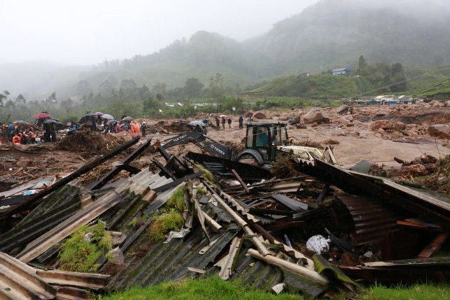
T.V. Sajeev, principal scientist with Kerala Forest Research Institute said quarrying, razing hills for constructions, large-scale road construction, and expansion in the mountains and mono-crop cultivations are turning contributing factors in the landslides because of incessant rains of high magnitude.
Over thirty percent of Idukki district is prone to landslides as per the landslide hazard profile map of Kerala Disaster Management Authority. The situation is highly critical in Munnar and its surroundings.
After the floods of 2018, the Kerala government had announced the launch of a micro-level landslide hazard mapping for the state apart from relocation and rehabilitation of people from ecologically fragile danger zones. But nothing has happened so far though the floods have become an annual phenomenon since then.
According to Gopakumar Cholayil, a senior scientific officer with Academy of Climate Change Education and Research of Kerala Agriculture University, rainfall patterns have changed drastically in the state and surrounding Western Ghats parts of Kodagu and the Nilgiris in the last two years with minimal rains in June and July and intense rainfall in August and September. The intensity of the rains has also increased. In Idukki, Peerumedu and Devikulam taluks have received 261 mm and 229.4 mm rainfall, respectively on August 7 alone.
Kerala has been facing extreme weather events in the past few years. The massive drought in 2015 was followed by the Okhi cyclone of 2017. Massive floods have occurred in 2018 and 2019, along with landslides. The most literate state in India now looks less aware of the implications of climate change.
According to C.P. Rajendran, geoscientist, and professor at the Jawaharlal Nehru Centre for Advanced Scientific Research in Bengaluru, it’s high time for Kerala to frame clear policies on land management and water utilisation. It also has to evolve long term strategies to address annual floods and landslides which target poor people who are forced to live in ecologically fragile lands. He said that there must be greater attention to avoid change in land utilisation patterns and also avoid initiation of large scale projects with substantial environmental implications.
According to Rajendran, the state requires land-use zoning regulations incorporated with landslide susceptibility data. “Kerala has about 19,000 sq km of hill areas with slopes higher than 10 degrees. These areas are thinly forested and largely disturbed by human activities,’’ he said. He is also of the opinion that a landslide susceptibility map can help the state to understand the kind and magnitude of possible landslides in different areas.
Landslides a new reality
Hydrogeologist V.R. Haridas said landslips and related phenomena are a new reality for Kerala and the state has to evolve long term strategies to address the threat.
Haridas, who extensively studied the Kavalappara and Puthumala landslips of last year under a Climate Adaptive Project of National Bank for Agriculture and Rural Development (NABARD), is of the opinion that Kerala’s soil structure has changed drastically. “It seems the changed soil structure cannot withstand heavy rains. The changes that occurred in the last three years have a common pattern. In the absence of comprehensive and scientific approaches, landslides with large numbers of casualties would turn an annual phenomenon,’’ he said.
Monocropping might have contributed to the situation in Pettimudi while indiscriminate granite quarrying stands as the major reason in other parts like Wayanad, Pathanamthitta and Malappuram, Haridas said.
Till three years ago, Kerala’s monsoon was confined to two to two-and-a-half months beginning on June 1. But about half of the 3,000 mm of annual rainfall is happening in one or two weeks in August-September. The Pettimudi incident coincides with the first anniversary of the devastating landslide at Puthumala in Wayanad, which claimed 17 lives. On the anniversary occasion, Puthumala and nearby Pachakkad had received over 1,500 mm of rains in six days. Last year’s landslide buried 58 homes and damaged 22 others, including a mosque, a temple, several lines of padis of Harrisons Malayalam estate, a canteen, post office, and a bridge.
“Rains this year are higher in intensity and strong winds are accompanying them. Climate change, along with COVID-19 lockdown, has made survival a difficult task in Kerala. People are struggling,’’ said Cholayil.
According to Haridas, rains in the last week with extremely high intensity have created a situation in Wayanad in which slopes of the hills reach a saturation level. “If rains persist, there would be a real risk of it triggering lateral movement and increasing chances of the overburden to slip,’’ he said.
Mohan C. Varghese, vice-president of Kannan Devan hills Plantation Company, a subsidiary of Tata Global beverages that owns the Pettimudi tea estate, said that immediate scientific studies are required on the sudden landslide that buried the workers’ settlement. “Unlike many other parts of Idukki, our estates lack any kind of deforestation or large scale constructions. For over a century, the company had made no alterations in the land use patterns. We lost many precious lives, and similar such instances must not be repeated. The company is ready to associate with any kind of expert studies,’’ he said.
According to sources in the Kerala Disaster Management Authority, landslides should not have come as a surprise as a range of Kerala’s districts comprising Wayanad, Idukki, Malappuram, and Kottayam witnessed a significant spurt in rainfall in the seven days between July 30 and August 5. Three low-intensity landslides had occurred close to Nilambur in Malappuram before the Pettimudi incident.
An extremely turbulent Arabian sea has started wreaking havoc in coastal areas like Ponnani and Vizhinjam, Floods have already inundated central Kerala towns of Pala, Eerattupeta, Koottikkal, and Mundakkayam.
In Pathanamthitta, three major rivers – Pampa, Manimala and Achenkoil – have risen beyond the warning level. Pampa Triveni, the entrance to pilgrim centre Sabarimala, which was devastated in the 2018 floods, has also been flooded.
“Frequent tectonic activities combined with changing weather patterns due to global warming are cited as reasons for natural calamities including landslides in the Himalayan region. We have to have scientific studies on tectonic activities in Kerala, especially in the upper ranges of Idukki,’’ said Varghese.
This article first appeared on Mongabay.

